Geolocate

Kadena topographic map

Click on the map to display elevation.

About this map
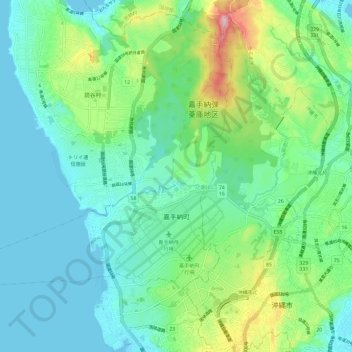
Name: Kadena topographic map, elevation, terrain.

Location: Kadena, Nakagami, Okinawa Prefecture, Japan (26.33809 127.67037 26.40796 127.78863)

Average elevation: 43 m

Minimum elevation: 0 m

Maximum elevation: 200 m

Gear up for your next adventure:

🚲Bike Repair Kit - Essential tools for on-trail mechanical issues
⛺Backpacking Tent - Lightweight tent for long-distance hiking trips
💡LED Camping Lantern - Illuminate your campsite with long-lasting lanterns
🚲MTB Frame Bag - Carry tools and maps directly on your bicycle frame
🧥Waterproof Pants - Keep dry during rainy hiking conditions

As an Amazon Associate, this site earns from qualifying purchases at no extra cost to you.