Geolocate

Uchucubamba topographic map

Click on the map to display elevation.

About this map

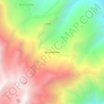
Name: Uchucubamba topographic map, elevation, terrain.

Location: Uchucubamba, Sitabamba, Santiago de Chuco, La Libertad, Perú (-8.06072 -77.74014 -8.02072 -77.70014)

Average elevation: 3,449 m

Minimum elevation: 2,569 m

Maximum elevation: 4,276 m

Gear up for your next adventure:

🥾Trail Hiking Boots - Supportive boots for rough trails
💡Portable Camping Lamp - Rechargeable lamp for campsite lighting
🪑Insulated Seat Pad - Protect your seat from cold rocks and wet logs
Lightweight Backpacking Tent - Compact tent for efficient hiking trips
🥾Hiking Leggings - Comfortable leggings for outdoor activities

As an Amazon Associate, this site earns from qualifying purchases at no extra cost to you.