Geolocate

Dagatan topographic map

Click on the map to display elevation.

About this map

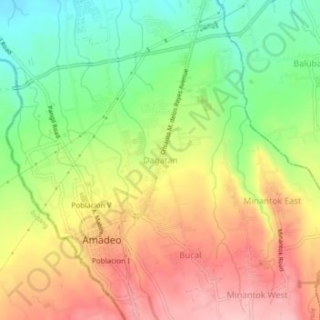
Name: Dagatan topographic map, elevation, terrain.

Location: Dagatan, Amadeo, Cavite, Calabarzon, 4119, Philippines (14.15983 120.90940 14.19983 120.94940)

Average elevation: 403 m

Minimum elevation: 327 m

Maximum elevation: 479 m

Gear up for your next adventure:

🥾Trail Hiking Boots - Supportive boots for rough trails
🔨Vehicle Emergency Tool - Safety tool for remote road trips to trailheads
🥾Light Trekking Boots - Supportive boots for multi-day treks
🧴Outdoor Sunscreen - High SPF protection for high-altitude UV exposure
👟Trail Running Shoes - Agile footwear for fast-paced topographic exploration

As an Amazon Associate, this site earns from qualifying purchases at no extra cost to you.