Geolocate

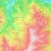
Le Collet d'en Bas topographic map

Click on the map to display elevation.

About this map

Name: Le Collet d'en Bas topographic map, elevation, terrain.

Location: Le Collet d'en Bas, Albiez-Montrond, Saint-Jean-de-Maurienne, Savoie, Auvergne-Rhône-Alpes, France métropolitaine, 73300, France (45.19896 6.29880 45.23896 6.33880)

Average elevation: 1,345 m

Minimum elevation: 719 m

Maximum elevation: 2,081 m

Other topographic maps

Click on a map to view its topography, its elevation and its terrain.
Montrond

France > Auvergne-Rhône-Alpes > Savoie > Albiez-Montrond

Average elevation: 2,048 m

Gear up for your next adventure:

🥾Trekking Boots - Durable boots for long-distance trekking
🧥Waterproof Pants - Keep dry during rainy hiking conditions
🔭Compact Binoculars - Lightweight optics for scouting trails and wildlife
🥾Trail Hiking Shoes - Durable shoes designed for rugged trails
🧭Orienteering Kit - Tools for map reading and navigation in the wild

As an Amazon Associate, this site earns from qualifying purchases at no extra cost to you.