Geolocate

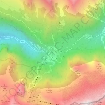
Sella Nevea topographic map

Click on the map to display elevation.

Sella Nevea

Sella Nevea (Friulian: Nevee, German: Neveasattel, Slovene: Na Žlebeh), at an altitude of 1,195 m (3,921 ft), is a high mountain pass in the Julian Alps, in the Friuli Venezia Giulia region of northeast Italy. Sella Nevea also lends its name to a frazione of the Chiusaforte municipality and the nearby Kanin-Sella Nevea Ski Resort.

Wikipedia (CC-BY-SA 3.0)

About this map

Name: Sella Nevea topographic map, elevation, terrain.

Location: Sella Nevea, Chiusaforte, Udine, Friuli-Venezia Giulia, 33010, Italy (46.36947 13.45412 46.40947 13.49412)

Average elevation: 1,545 m

Minimum elevation: 769 m

Maximum elevation: 2,356 m

Gear up for your next adventure:

💡LED Headlamp - Hands-free illumination for night hiking and camping
🧣Merino Neck Gaiter - Protects against wind, sun, and cold at high altitudes
🚲Heavy Duty Bike Lock - Secure your bike at the trailhead or during stops
🥾Mountain Hiking Boots - High-traction boots for rocky terrain
🔦UV Flashlight - Detect minerals or specific insects in the dark

As an Amazon Associate, this site earns from qualifying purchases at no extra cost to you.