
Thank you for supporting this site ❤️
Make a donation
Make a donation
Gear up for your next adventure:
As an Amazon Associate, this site earns from qualifying purchases at no extra cost to you.
Saraguro topographic map
Click on the map to display elevation.
Thank you for supporting this site ❤️
Make a donation
Make a donation
Gear up for your next adventure:
As an Amazon Associate, this site earns from qualifying purchases at no extra cost to you.
About this map
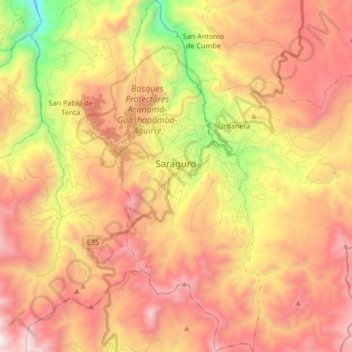
Name: Saraguro topographic map, elevation, terrain.
Location: Saraguro, Cantón Saraguro, Loja, 111150, Ecuador (-3.71103 -79.26757 -3.54583 -79.19829)
Average elevation: 2,753 m
Minimum elevation: 1,708 m
Maximum elevation: 3,571 m
Thank you for supporting this site ❤️
Make a donation
Make a donation
Gear up for your next adventure:
As an Amazon Associate, this site earns from qualifying purchases at no extra cost to you.