Geolocate

Miranda topographic map

Click on the map to display elevation.

About this map

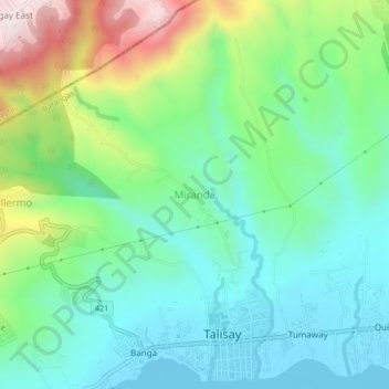
Name: Miranda topographic map, elevation, terrain.

Location: Miranda, Talisay, Batangas, Calabarzon, 4220, Philippines (14.08800 120.99764 14.12800 121.03764)

Average elevation: 178 m

Minimum elevation: 3 m

Maximum elevation: 602 m

Other topographic maps

Click on a map to view its topography, its elevation and its terrain.

Talisay Baywalk

Philippines > Batangas > Talisay

Average elevation: 21 m

Gear up for your next adventure:

🩹Compact First Aid Kit - Pre-packed essentials for common trail injuries
🔪Outdoor Multitool - Versatile tool for repairs and food prep in the wild
🧥Softshell Jacket - Windproof and breathable jacket for hiking
🧶550 Survival Paracord - Versatile utility cord for emergency repairs and rigging
🥫Freeze-Dried Meals - Lightweight, high-calorie nutrition for multi-day treks

As an Amazon Associate, this site earns from qualifying purchases at no extra cost to you.