Geolocate

Gajapati topographic map

Click on the map to display elevation.

About this map

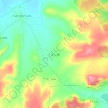
Name: Gajapati topographic map, elevation, terrain.

Location: Gajapati, Hukkeri taluk, Belagavi District, Karnataka, India (16.00766 74.57543 16.04766 74.61543)

Average elevation: 737 m

Minimum elevation: 685 m

Maximum elevation: 802 m

Gear up for your next adventure:

🔦LED Headlamp - Hands-free lighting for early morning starts or late finishes
🧥Waterproof Jacket - Lightweight rain jackets for hiking and outdoor activities
👟Trail Running Shoes - Agile footwear for fast-paced topographic exploration
🥾Mountaineering Boots - Supportive boots for climbing and high-altitude hiking
🧳Compression Sacks - Maximize space in your backpack by shrinking gear

As an Amazon Associate, this site earns from qualifying purchases at no extra cost to you.