Geolocate

Umroi topographic map

Click on the map to display elevation.

About this map

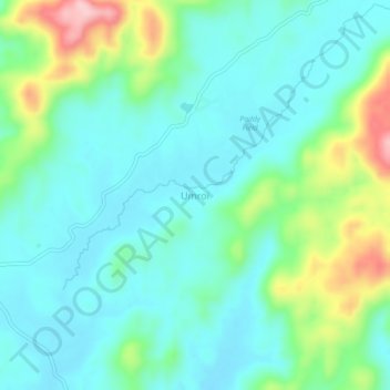
Name: Umroi topographic map, elevation, terrain.

Location: Umroi, Umsning, Ri-Bhoi District, Meghalaya, 793103, India (25.69389 92.01965 25.73389 92.05965)

Average elevation: 914 m

Minimum elevation: 864 m

Maximum elevation: 1,066 m

Gear up for your next adventure:

Camping Coffee Maker - Brew fresh coffee anywhere on the topographic map
🔋Emergency Crank Radio - Weather alerts and power without needing batteries
🧥Insulated Jacket - Keep warm in cold outdoor conditions
🛰️Satellite Messenger - Emergency communication for areas with no cell service
🥾Trail Hiking Shoes - Durable shoes designed for rugged trails

As an Amazon Associate, this site earns from qualifying purchases at no extra cost to you.