Geolocate

Castejón topographic map

Click on the map to display elevation.

About this map

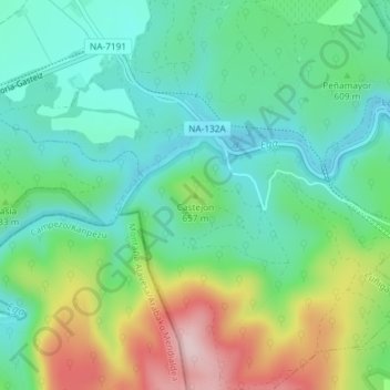
Name: Castejón topographic map, elevation, terrain.

Location: Castejón, Zúñiga, Tierra Estella, Navarra, 31282, España (42.67845 -2.28835 42.67855 -2.28825)

Average elevation: 612 m

Minimum elevation: 520 m

Maximum elevation: 814 m

Gear up for your next adventure:

🧦Crew Hiking Socks - Comfortable socks for long-distance hikes
🗺️Topographic Maps - Detailed maps to explore trails, mountains, and wilderness areas
🧣Merino Neck Gaiter - Protects against wind, sun, and cold at high altitudes
👖Convertible Hiking Pants - Zip-off legs to adapt to changing weather conditions
🥾Trail Running Shoes - Lightweight and durable shoes for trail running

As an Amazon Associate, this site earns from qualifying purchases at no extra cost to you.