Geolocate

Etah topographic map

Click on the map to display elevation.

About this map

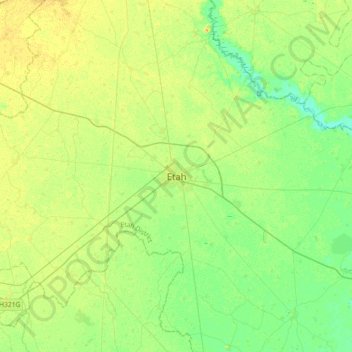
Name: Etah topographic map, elevation, terrain.

Location: Etah, Etah District, Uttar Pradesh, 207001, India (27.40002 78.49784 27.72002 78.81784)

Average elevation: 169 m

Minimum elevation: 159 m

Maximum elevation: 180 m

Gear up for your next adventure:

🚲MTB Frame Bag - Carry tools and maps directly on your bicycle frame
🛌Insulated Sleeping Pad - Critical thermal barrier between you and the cold ground
🧢Outdoor Visor - Breathable visor for sunny hikes
🔋Solar Power Bank - Keep your GPS and devices charged during long outdoor trips
🧢Beanie Hat - Keep your head warm in cold weather

As an Amazon Associate, this site earns from qualifying purchases at no extra cost to you.