Geolocate

Walluf topographic map

Click on the map to display elevation.

About this map

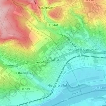
Name: Walluf topographic map, elevation, terrain.

Location: Walluf, Rheingau-Taunus-Kreis, Hesse, 65396, Germany (50.02981 8.12732 50.06881 8.17516)

Average elevation: 150 m

Minimum elevation: 79 m

Maximum elevation: 293 m

Gear up for your next adventure:

🥾Trekking Poles - Adjustable trekking poles to reduce knee stress and improve stability
🧥Softshell Jacket - Windproof and breathable jacket for hiking
❄️Traction Ice Cleats - Slip-on spikes for icy trails and winter hiking
🧴Waterproofing Spray - Restore the DWR coating on jackets and tents
🔭Compact Binoculars - Lightweight optics for scouting trails and wildlife

As an Amazon Associate, this site earns from qualifying purchases at no extra cost to you.