Geolocate

Bomdila topographic map

Click on the map to display elevation.

About this map

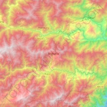
Name: Bomdila topographic map, elevation, terrain.

Location: Bomdila, Bomdila HQ, West Kameng, Arunachal Pradesh, India (27.10445 92.26065 27.42445 92.58065)

Average elevation: 2,033 m

Minimum elevation: 409 m

Maximum elevation: 3,286 m

Gear up for your next adventure:

🧴Bear Spray Holster - Quick-access carry for essential Canadian wilderness safety
🧢Hiking Hat - Sun-protective and breathable hats for long treks
🧭GPS Handheld Device - Reliable GPS navigation for outdoor adventures
🥾Trail Hiking Boots - Supportive boots for rough trails
🧰Survival Kit - Essential gear for emergencies in the wilderness

As an Amazon Associate, this site earns from qualifying purchases at no extra cost to you.