Geolocate

Lagro topographic map

Click on the map to display elevation.

About this map

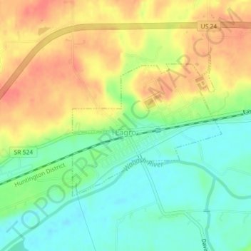
Name: Lagro topographic map, elevation, terrain.

Location: Lagro, Wabash County, Indiana, United States (40.83120 -85.73783 40.84646 -85.71658)

Average elevation: 227 m

Minimum elevation: 201 m

Maximum elevation: 254 m

Gear up for your next adventure:

🧥Insulated Jacket - Keep warm in cold outdoor conditions
🧢Outdoor Visor - Breathable visor for sunny hikes
🥾Waterproof Hiking Shoes - Durable shoes for wet and rugged trails
🧥Fleece Jacket - Warm and lightweight jacket for layering
🕯️Camping Lantern - Illuminates your entire campsite with high-efficiency LEDs

As an Amazon Associate, this site earns from qualifying purchases at no extra cost to you.