Geolocate

Torre Pali topographic map

Click on the map to display elevation.

About this map

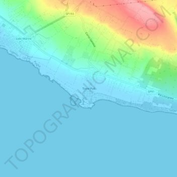
Name: Torre Pali topographic map, elevation, terrain.

Location: Torre Pali, Salve, Lecce, Puglia, Italia (39.82099 18.18728 39.86099 18.22728)

Average elevation: 21 m

Minimum elevation: -4 m

Maximum elevation: 111 m

Gear up for your next adventure:

🥾Hiking Shorts - Breathable shorts suitable for summer hikes
📷Outdoor Action Camera - Capture high-elevation views and rugged adventures
🧦Hiking Socks - Moisture-wicking and comfortable socks for long hikes
Camping Tent - Weather-resistant tents suitable for 2 to 6 people
Camping Groundsheet - Protect your tent from moisture and dirt

As an Amazon Associate, this site earns from qualifying purchases at no extra cost to you.