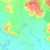
Arvi topographic map
Click on the map to display elevation.
Arvi
Arvi is located at 20°35′N 79°08′E / 20.59°N 79.14°E / 20.59; 79.14. It has an average elevation of 328 metres (1075 feet). Arvi is an important centre for the cotton and soybean trade. The closest airport from Arvi is Nagpur Airport situated at 100 kilometres and the closest Railway Station From Arvi is Pulgoan Junction situated at 35 kilometres.The location of Arvi is on Ravandev Garmasur Plateau, which is also a reason for the growth of long thread bearing cotton. Wardha river and Bakli river flowing alongside the borders of Arvi taluka are the main source of water for the villages.
About this map

Name: Arvi topographic map, elevation, terrain.
Location: Arvi, Wardha District, Maharashtra, 442200, India (20.98191 78.22460 21.00558 78.24286)
Average elevation: 302 m
Minimum elevation: 287 m
Maximum elevation: 314 m
Other topographic maps
Click on a map to view its topography, its elevation and its terrain.