
Thank you for supporting this site ❤️
Make a donation
Make a donation
Gear up for your next adventure:
As an Amazon Associate, this site earns from qualifying purchases at no extra cost to you.
Savelletri topographic map
Click on the map to display elevation.
Thank you for supporting this site ❤️
Make a donation
Make a donation
Gear up for your next adventure:
As an Amazon Associate, this site earns from qualifying purchases at no extra cost to you.
About this map
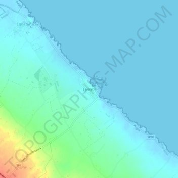
Name: Savelletri topographic map, elevation, terrain.
Location: Savelletri, Fasano, Brindisi, Puglia, Italia (40.85303 17.38896 40.89303 17.42896)
Average elevation: 8 m
Minimum elevation: -5 m
Maximum elevation: 54 m
Thank you for supporting this site ❤️
Make a donation
Make a donation
Gear up for your next adventure:
As an Amazon Associate, this site earns from qualifying purchases at no extra cost to you.