Geolocate

Des Moines topographic map

Click on the map to display elevation.

About this map
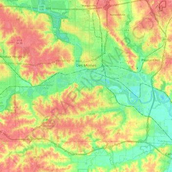
Name: Des Moines topographic map, elevation, terrain.

Location: Des Moines, Polk County, Iowa, United States (41.47964 -93.70914 41.65891 -93.49369)

Average elevation: 265 m

Minimum elevation: 229 m

Maximum elevation: 303 m

Other topographic maps

Click on a map to view its topography, its elevation and its terrain.

Saylorville

United States > Iowa > Polk County

Average elevation: 266 m

Gear up for your next adventure:

🧥Softshell Hiking Jacket - The perfect balance of wind protection and breathability
🎒Hiking Backpack - Lightweight and ergonomic backpacks for day hikes or multi-day treks
🍽️Titanium Camping Spork - Ultralight and indestructible eating utensil
🥾Hiking Shoes - Durable and comfortable shoes for trail hiking
🧦Hiking Liner Socks - Thin base layer to prevent friction and blisters

As an Amazon Associate, this site earns from qualifying purchases at no extra cost to you.