Geolocate

Albany topographic map

Click on the map to display elevation.

About this map

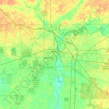
Name: Albany topographic map, elevation, terrain.

Location: Albany, Dougherty County, Georgia, United States (31.52238 -84.27299 31.62304 -84.05864)

Average elevation: 65 m

Minimum elevation: 46 m

Maximum elevation: 86 m

Other topographic maps

Click on a map to view its topography, its elevation and its terrain.

Audubon

United States > Georgia > Dougherty County > Albany

Average elevation: 68 m

Evergreen

United States > Georgia > Dougherty County > Albany

Average elevation: 60 m

Evergreen

United States > Georgia > Dougherty County > Albany

Average elevation: 60 m

Westwood

United States > Georgia > Dougherty County > Albany

Average elevation: 68 m

Sunnyland

United States > Georgia > Dougherty County > Albany

Average elevation: 59 m

Evergreen

United States > Georgia > Dougherty County > Albany

Average elevation: 60 m

Gear up for your next adventure:

🔦UV Flashlight - Detect minerals or specific insects in the dark
🥾Trail Running Boots - Durable shoes designed for trail running
🥾Trail Hiking Socks - Comfortable socks to prevent blisters and fatigue
🧢Outdoor Cap - Protective cap for sun and rain during hikes
🧭GPS Handheld Device - Reliable GPS navigation for outdoor adventures

As an Amazon Associate, this site earns from qualifying purchases at no extra cost to you.