
Thank you for supporting this site ❤️
Make a donation
Make a donation
Gear up for your next adventure:
As an Amazon Associate, this site earns from qualifying purchases at no extra cost to you.
Guanacastillo topographic map
Click on the map to display elevation.
Thank you for supporting this site ❤️
Make a donation
Make a donation
Gear up for your next adventure:
As an Amazon Associate, this site earns from qualifying purchases at no extra cost to you.
About this map
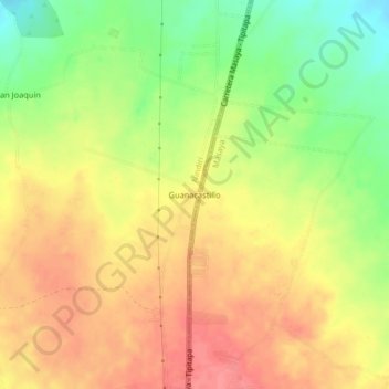
Name: Guanacastillo topographic map, elevation, terrain.
Location: Guanacastillo, Nindirí, Masaya, 42200, Nicaragua (12.05392 -86.12205 12.09392 -86.08205)
Average elevation: 179 m
Minimum elevation: 137 m
Maximum elevation: 210 m
Thank you for supporting this site ❤️
Make a donation
Make a donation
Gear up for your next adventure:
As an Amazon Associate, this site earns from qualifying purchases at no extra cost to you.