Geolocate

Anislag topographic map

Click on the map to display elevation.

About this map

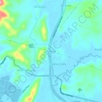
Name: Anislag topographic map, elevation, terrain.

Location: Anislag, Calbayog, Samar, Eastern Visayas, 6710, Philippines (12.08294 124.51049 12.12294 124.55049)

Average elevation: 24 m

Minimum elevation: -3 m

Maximum elevation: 160 m

Other topographic maps

Click on a map to view its topography, its elevation and its terrain.

Gear up for your next adventure:

🥾Mountaineering Boots - Supportive boots for climbing and high-altitude hiking
🚲Bike Repair Kit - Essential tools for on-trail mechanical issues
🧤Thermal Hiking Gloves - Grip-enhanced gloves for cold-weather altitude trekking
Family Camping Tent - Spacious tent suitable for family camping trips
🧼Travel Hand Sanitizer - Keep hands clean when water is scarce

As an Amazon Associate, this site earns from qualifying purchases at no extra cost to you.