Geolocate

Yaurilla topographic map

Click on the map to display elevation.

About this map

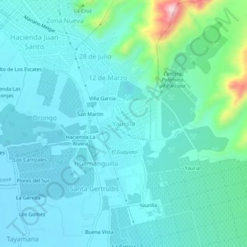
Name: Yaurilla topographic map, elevation, terrain.

Location: Yaurilla, Parcona, Ica, 11000, Perú (-14.08739 -75.70372 -14.04739 -75.66372)

Average elevation: 456 m

Minimum elevation: 408 m

Maximum elevation: 722 m

Gear up for your next adventure:

🎒Hiking Backpack - Lightweight and ergonomic backpacks for day hikes or multi-day treks
🪑Ultralight Camping Stool - Compact seating for rest stops during long hikes
🚲Handlebar Phone Mount - View topographic-map.com live while cycling
🦯Trekking Poles - Reduced impact on joints for steep topographic climbs
🥾Waterproof Hiking Boots - Boots keeping your feet dry in wet conditions

As an Amazon Associate, this site earns from qualifying purchases at no extra cost to you.