Geolocate

Terespol topographic map

Click on the map to display elevation.

About this map

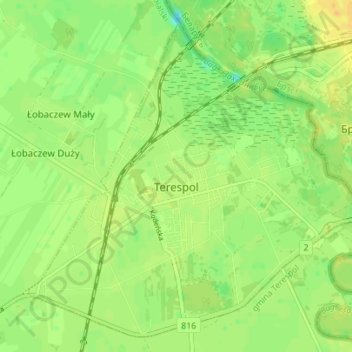
Name: Terespol topographic map, elevation, terrain.

Location: Terespol, Biała Podlaska County, Lublin Voivodeship, Poland (52.05739 23.58417 52.09567 23.65385)

Average elevation: 133 m

Minimum elevation: 119 m

Maximum elevation: 144 m

Gear up for your next adventure:

🥫Freeze-Dried Meals - Lightweight, high-calorie nutrition for multi-day treks
🥾Durable Hiking Shoes - Long-lasting shoes for frequent hiking
🥾Light Trekking Boots - Supportive boots for multi-day treks
💡LED Headlamp - Hands-free illumination for night hiking and camping
📷Outdoor Action Camera - Capture high-elevation views and rugged adventures

As an Amazon Associate, this site earns from qualifying purchases at no extra cost to you.