
Thank you for supporting this site ❤️
Make a donation
Make a donation
Gear up for your next adventure:
As an Amazon Associate, this site earns from qualifying purchases at no extra cost to you.
Villaretto topographic map
Click on the map to display elevation.
Thank you for supporting this site ❤️
Make a donation
Make a donation
Gear up for your next adventure:
As an Amazon Associate, this site earns from qualifying purchases at no extra cost to you.
About this map
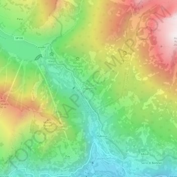
Name: Villaretto topographic map, elevation, terrain.
Location: Villaretto, Pontechianale, Cuneo, Piedmont, Italy (44.58538 7.04493 44.62538 7.08493)
Average elevation: 1,807 m
Minimum elevation: 1,238 m
Maximum elevation: 2,639 m
Thank you for supporting this site ❤️
Make a donation
Make a donation
Gear up for your next adventure:
As an Amazon Associate, this site earns from qualifying purchases at no extra cost to you.