Geolocate

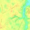
Rembert topographic map

Click on the map to display elevation.

About this map

Name: Rembert topographic map, elevation, terrain.

Location: Rembert, Sumter County, South Carolina, United States (34.08059 -80.55580 34.12127 -80.50981)

Average elevation: 64 m

Minimum elevation: 44 m

Maximum elevation: 88 m

Other topographic maps

Click on a map to view its topography, its elevation and its terrain.
Swinton

United States > South Carolina > Sumter County

Average elevation: 57 m

Horatio

United States > South Carolina > Sumter County

Average elevation: 45 m

Borden

United States > South Carolina > Sumter County

Average elevation: 71 m

Gear up for your next adventure:

🧥Softshell Jacket - Windproof and breathable jacket for hiking
💧Filtered Water Bottle - Safe drinking water on the go
🥾Hiking Shoes - Durable and comfortable shoes for trail hiking
🧭Orienteering Kit - Tools for map reading and navigation in the wild
🦟Insect Repellent - Keep mosquitoes and black flies away in wooded areas

As an Amazon Associate, this site earns from qualifying purchases at no extra cost to you.