
Carretas topographic map
Interactive map
Click on the map to display elevation.
About this map
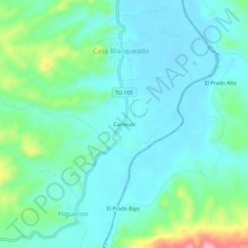
Name: Carretas topographic map, elevation, terrain.
Location: Carretas, Casa Blanqueada, San Jacinto, Tumbes, Perú (-3.76944 -80.47334 -3.72944 -80.43334)
Average elevation: 52 m
Minimum elevation: 18 m
Maximum elevation: 179 m