Geolocate

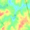
Mountville topographic map

Click on the map to display elevation.

About this map

Name: Mountville topographic map, elevation, terrain.

Location: Mountville, Laurens County, South Carolina, United States (34.34327 -81.99300 34.38200 -81.95508)

Average elevation: 183 m

Minimum elevation: 151 m

Maximum elevation: 204 m

Other topographic maps

Click on a map to view its topography, its elevation and its terrain.
Gear up for your next adventure:

🧦Merino Wool Socks - Moisture-wicking comfort for long-distance hiking
🛶Waterproof Dry Bags - Keep electronics and clothes dry during river crossings
🧭GPS Handheld Device - Reliable GPS navigation for outdoor adventures
⛺Tent Footprint - Protect tent floor and increase durability
🧥Insulated Jacket - Keep warm in cold outdoor conditions

As an Amazon Associate, this site earns from qualifying purchases at no extra cost to you.