Geolocate

Nallathanni topographic map

Click on the map to display elevation.

About this map

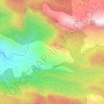
Name: Nallathanni topographic map, elevation, terrain.

Location: Nallathanni, Devikulam, Idukki, Kerala, India (10.10332 76.96581 10.15436 77.01802)

Average elevation: 1,291 m

Minimum elevation: 521 m

Maximum elevation: 2,073 m

Other topographic maps

Click on a map to view its topography, its elevation and its terrain.

Muttukadu

India > Kerala > Idukki

Average elevation: 1,096 m

Pettimudi Hill Top

India > Kerala > Idukki

Average elevation: 810 m

Muthirapuzha

India > Kerala > Idukki

Average elevation: 551 m

Idukki Dam

India > Kerala > Idukki

Average elevation: 701 m

Silent vally thodu

India > Kerala > Idukki

Average elevation: 1,668 m

Mattupetty Dam

India > Kerala > Idukki

Average elevation: 1,665 m

Malankara Dam

India > Kerala > Idukki

Average elevation: 59 m

Chokramudi

India > Kerala > Idukki

Average elevation: 1,670 m

Gear up for your next adventure:

🎒Backpack Rain Cover - External shield to keep your entire pack dry
🔥Camping Stove - Portable stoves to cook outdoors with ease
💧Reusable Water Bottle - Durable water bottles for hydration on trails
🧢Outdoor Visor - Breathable visor for sunny hikes
🔨Vehicle Emergency Tool - Safety tool for remote road trips to trailheads

As an Amazon Associate, this site earns from qualifying purchases at no extra cost to you.