Geolocate

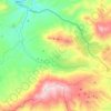
Harraza topographic map

Click on the map to display elevation.

About this map

Name: Harraza topographic map, elevation, terrain.

Location: Harraza, Haraza, Mansourah District, Bordj Bou Arreridj, 34000, Algeria (36.11822 4.19750 36.15822 4.23750)

Average elevation: 1,064 m

Minimum elevation: 795 m

Maximum elevation: 1,342 m

Other topographic maps

Click on a map to view its topography, its elevation and its terrain.
Gear up for your next adventure:

🩹Moleskin Blister Pads - Direct protection for painful foot pressure points
🥾Lightweight Hiking Boots - Boots for comfort and mobility on long hikes
🧊Portable Cooler - Keep food and drinks cold during outdoor adventures
💧Filtered Water Bottle - Safe drinking water on the go
🧰Multitool Knife - Compact and versatile tool for outdoor use

As an Amazon Associate, this site earns from qualifying purchases at no extra cost to you.