Geolocate

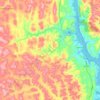
Enseada topographic map

Click on the map to display elevation.

About this map

Name: Enseada topographic map, elevation, terrain.

Location: Enseada, Maragogipe, Bahia, Região Nordeste, 44220-000, Brasil (-12.88617 -38.84618 -12.84617 -38.80618)

Average elevation: 24 m

Minimum elevation: -1 m

Maximum elevation: 144 m

Other topographic maps

Click on a map to view its topography, its elevation and its terrain.
Coqueiros

Brasil > Bahia > Maragogipe

Average elevation: 131 m

São Roque do Paraguaçu

Brasil > Bahia > Maragogipe

Average elevation: 42 m

Gear up for your next adventure:

🧭GPS Tracker - Track your location in remote areas safely
💡Compact LED Flashlight - Powerful and portable flashlight for outdoor use
🥾Trail Running Boots - Durable shoes designed for trail running
💧Reusable Water Bottle - Durable water bottles for hydration on trails
🥾Durable Hiking Shoes - Long-lasting shoes for frequent hiking

As an Amazon Associate, this site earns from qualifying purchases at no extra cost to you.