Geolocate

Vipota topographic map

Click on the map to display elevation.

About this map

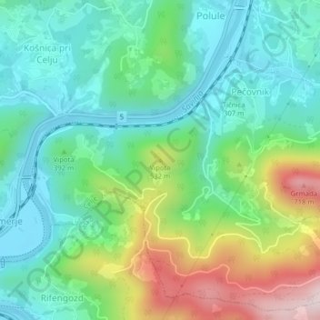
Name: Vipota topographic map, elevation, terrain.

Location: Vipota, Celje, 3104, Slovenia (46.20360 15.25374 46.20370 15.25384)

Average elevation: 373 m

Minimum elevation: 223 m

Maximum elevation: 726 m

Gear up for your next adventure:

💧Hydration Pack - Hands-free hydration system for long hikes
🧢Sun Protection Cap - Breathable cap to protect from sun exposure
🧦Crew Hiking Socks - Comfortable socks for long-distance hikes
🦌Outdoor Trail Camera - Monitor wildlife activity near your favorite spots
🧭GPS Handheld Device - Reliable GPS navigation for outdoor adventures

As an Amazon Associate, this site earns from qualifying purchases at no extra cost to you.