Föhr topographic map
Click on the map to display elevation.
Föhr
Föhr is called "The Green Island" due to being sheltered from the storms of the North Sea by its neighbouring islands Sylt and Amrum, so that Föhr's vegetation is thriving compared to that of the other islands. It is 6.8 kilometres wide and 12 km long; the surface measures 82.82 km2. While the northern parts are marshland, the south consists of higher geestland. The highest elevation measures 13 m above mean sea level and is located on the geestland ridge between the villages of Nieblum and Midlum. The geest makes up about two fifths of Föhr's total area and most villages are located there. In the marshlands, a number of solitary farmsteads can be found, which were moved out of the villages during the 1960s.
About this map
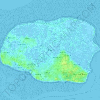
Name: Föhr topographic map, elevation, terrain.
Location: Föhr, Northern Friesland, Schleswig-Holstein, 25938, Germany (54.67921 8.39497 54.75550 8.59682)
Average elevation: 1 m
Minimum elevation: -3 m
Maximum elevation: 14 m
Other topographic maps
Click on a map to view its topography, its elevation and its terrain.