Geolocate

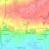
Saint-Marc topographic map

Click on the map to display elevation.

About this map

Name: Saint-Marc topographic map, elevation, terrain.

Location: Saint-Marc, Guipry, Guipry-Messac, Redon, Ille-et-Vilaine, Bretagne, France métropolitaine, 35480, France (47.75321 -1.86412 47.79321 -1.82412)

Average elevation: 45 m

Minimum elevation: 3 m

Maximum elevation: 101 m

Other topographic maps

Click on a map to view its topography, its elevation and its terrain.

Guipry

France > Bretagne > Ille-et-Vilaine > Guipry-Messac

Average elevation: 48 m

Gear up for your next adventure:

🧥Waterproof Pants - Keep dry during rainy hiking conditions
🥾Hiking Leggings - Comfortable leggings for outdoor activities
🥾Trail Running Shoes - Lightweight and durable shoes for trail running
💧Hydration Bladder - Hands-free hydration solution for long treks
🛏️Sleeping Bag - Warm and compact sleeping bags for outdoor camping

As an Amazon Associate, this site earns from qualifying purchases at no extra cost to you.