Geolocate

Blue River topographic map

Interactive map

Click on the map to display elevation.

About this map

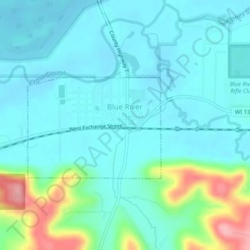
Name: Blue River topographic map, elevation, terrain.

Location: Blue River, Grant County, Wisconsin, United States (43.18011 -90.58188 43.19167 -90.56207)

Average elevation: 223 m

Minimum elevation: 198 m

Maximum elevation: 323 m

Other topographic maps

Click on a map to view its topography, its elevation and its terrain.

Platteville

United States > Wisconsin > Grant County

Platteville, Grant County, Wisconsin, 53818, United States

Average elevation: 295 m

Potosi

United States > Wisconsin > Grant County

Potosi, Grant County, Wisconsin, United States

Average elevation: 264 m

Town of Potosi

United States > Wisconsin > Grant County

Town of Potosi, Grant County, Wisconsin, 53820, United States

Average elevation: 251 m