Geolocate

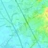
Lambakin topographic map

Click on the map to display elevation.

About this map

Name: Lambakin topographic map, elevation, terrain.

Location: Lambakin, Marilao, Bulacan, Central Luzon, Philippines (14.75989 120.95727 14.77972 120.98604)

Average elevation: 18 m

Minimum elevation: 6 m

Maximum elevation: 36 m

Other topographic maps

Click on a map to view its topography, its elevation and its terrain.
Marilao

Philippines > Bulacan > Marilao

Average elevation: 7 m

Lias

Philippines > Bulacan > Marilao

Average elevation: 9 m

Gear up for your next adventure:

⛺Camping Groundsheet - Protect your tent from moisture and dirt
🧢Outdoor Visor - Breathable visor for sunny hikes
🚲Heavy Duty Bike Lock - Secure your bike at the trailhead or during stops
☕Camping Coffee Maker - Brew fresh coffee anywhere on the topographic map
👟Sport Hiking Sandals - Breathable footwear for water crossings and camp rest

As an Amazon Associate, this site earns from qualifying purchases at no extra cost to you.