Geolocate

Sebt topographic map

Click on the map to display elevation.

About this map
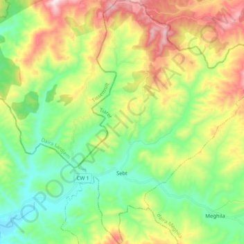
Name: Sebt topographic map, elevation, terrain.

Location: Sebt, Meghila District, Tiaret, Algeria (35.58160 1.32357 35.71136 1.43816)

Average elevation: 670 m

Minimum elevation: 395 m

Maximum elevation: 1,156 m

Gear up for your next adventure:

🧥Insulated Jacket - Keep warm in cold outdoor conditions
🥾Mountain Hiking Shoes - Shoes with superior grip for mountainous terrain
💡Portable Camping Lamp - Rechargeable lamp for campsite lighting
🔦LED Flashlight - Powerful and long-lasting flashlight for camping and emergencies
🥾Waterproof Hiking Boots - Essential footwear for rugged terrain and wet Canadian trails

As an Amazon Associate, this site earns from qualifying purchases at no extra cost to you.