

Vogelenzang topographic map
Click on the map to display elevation.
Vogelenzang
De vlag kan worden omschreven als: Twee even lange banen van rood en blauw met over het midden een witte geschreefde letter V over de hele hoogte van de vlag. De linkertak van de V is twee maal zo dik als de rechtertak. Van binnen is de V geel opgevuld, met op het geel langs binnenzijde van de linkertak van de V en geplaatst in de zin daarvan drie groene vogels.
About this map
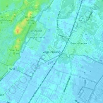
Name: Vogelenzang topographic map, elevation, terrain.
Location: Vogelenzang, Noord-Holland, Nederland, 2114, Nederland (52.29913 4.55630 52.33913 4.59630)
Average elevation: 3 m
Minimum elevation: -6 m
Maximum elevation: 23 m
Other topographic maps
Click on a map to view its topography, its elevation and its terrain.
