
Thank you for supporting this site ❤️
Make a donation
Make a donation
Gear up for your next adventure:
As an Amazon Associate, this site earns from qualifying purchases at no extra cost to you.
Farrobo topographic map
Click on the map to display elevation.
Thank you for supporting this site ❤️
Make a donation
Make a donation
Gear up for your next adventure:
As an Amazon Associate, this site earns from qualifying purchases at no extra cost to you.
About this map
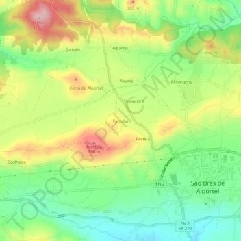
Name: Farrobo topographic map, elevation, terrain.
Location: Farrobo, São Brás de Alportel, Faro, 8150-014, Portugal (37.14392 -7.92607 37.18392 -7.88607)
Average elevation: 280 m
Minimum elevation: 182 m
Maximum elevation: 415 m
Thank you for supporting this site ❤️
Make a donation
Make a donation
Gear up for your next adventure:
As an Amazon Associate, this site earns from qualifying purchases at no extra cost to you.