Geolocate

Paia topographic map

Click on the map to display elevation.

About this map

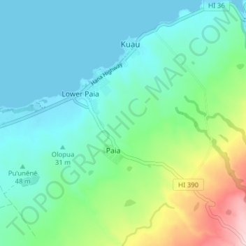
Name: Paia topographic map, elevation, terrain.

Location: Paia, Maui County, Hawaii, 96779, United States (20.87947 -156.39540 20.93861 -156.34868)

Average elevation: 69 m

Minimum elevation: 0 m

Maximum elevation: 300 m

Gear up for your next adventure:

🧦Hiking Liner Socks - Thin base layer to prevent friction and blisters
💡Solar Camping Lamp - Eco-friendly lighting for campsites
🧣Evaporative Cooling Towel - Beat the heat during intense summer climbs
🕶️Polarized Sunglasses - Protect your eyes with durable polarized lenses
Family Camping Tent - Spacious tent suitable for family camping trips

As an Amazon Associate, this site earns from qualifying purchases at no extra cost to you.