Geolocate

San Rafael topographic map

Click on the map to display elevation.

About this map

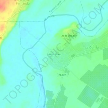
Name: San Rafael topographic map, elevation, terrain.

Location: San Rafael, Castilla, Piura, Perú (-5.00718 -80.60986 -4.96718 -80.56986)

Average elevation: 49 m

Minimum elevation: 36 m

Maximum elevation: 88 m

Other topographic maps

Click on a map to view its topography, its elevation and its terrain.

Gear up for your next adventure:

🛏️Camping Sleeping Mat - Comfortable mats for sleeping outdoors
🎒Hiking Backpack - Lightweight and ergonomic backpacks for day hikes or multi-day treks
Bushcraft Tarp - Versatile emergency shelter or gear protection
🥾Mountain Hiking Shoes - Shoes with superior grip for mountainous terrain
🧭GPS Handheld Device - Reliable GPS navigation for outdoor adventures

As an Amazon Associate, this site earns from qualifying purchases at no extra cost to you.