Geolocate

Kareda topographic map

Click on the map to display elevation.

About this map

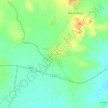
Name: Kareda topographic map, elevation, terrain.

Location: Kareda, Kareda Tehsil, Bhilwara, Rajasthan, 311804, India (25.49551 74.20624 25.53551 74.24624)

Average elevation: 530 m

Minimum elevation: 515 m

Maximum elevation: 556 m

Gear up for your next adventure:

Camping Coffee Maker - Brew fresh coffee anywhere on the topographic map
🧢Outdoor Cap - Protective cap for sun and rain during hikes
Tent Footprint - Protect tent floor and increase durability
🛶Kayak Dry Bag - Waterproof storage for kayaking adventures
🧦Hiking Liner Socks - Thin base layer to prevent friction and blisters

As an Amazon Associate, this site earns from qualifying purchases at no extra cost to you.