Geolocate

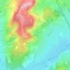
Bonnay topographic map

Click on the map to display elevation.

About this map

Name: Bonnay topographic map, elevation, terrain.

Location: Bonnay, Bonnay-Saint-Ythaire, Mâcon, Saône-et-Loire, Bourgogne-Franche-Comté, France métropolitaine, 71460, France (46.52996 4.58753 46.56938 4.65898)

Average elevation: 256 m

Minimum elevation: 197 m

Maximum elevation: 412 m

Other topographic maps

Click on a map to view its topography, its elevation and its terrain.
Gear up for your next adventure:

🦯Trekking Poles - Reduced impact on joints for steep topographic climbs
🛰️Satellite Messenger - Emergency communication for areas with no cell service
💡LED Headlamp - Hands-free illumination for night hiking and camping
🥾All-Terrain Hiking Boots - Versatile boots for varied hiking conditions
🕶️Polarized Sunglasses - Reduces glare from snow and water at high elevations

As an Amazon Associate, this site earns from qualifying purchases at no extra cost to you.