
Thank you for supporting this site ❤️
Make a donation
Make a donation
Gear up for your next adventure:
As an Amazon Associate, this site earns from qualifying purchases at no extra cost to you.
Şentepe topographic map
Click on the map to display elevation.
Thank you for supporting this site ❤️
Make a donation
Make a donation
Gear up for your next adventure:
As an Amazon Associate, this site earns from qualifying purchases at no extra cost to you.
About this map
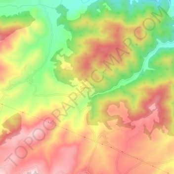
Name: Şentepe topographic map, elevation, terrain.
Location: Şentepe, Vezirköprü, Samsun, Black Sea Region, Turkey (41.19575 35.17044 41.23575 35.21044)
Average elevation: 419 m
Minimum elevation: 211 m
Maximum elevation: 585 m
Thank you for supporting this site ❤️
Make a donation
Make a donation
Gear up for your next adventure:
As an Amazon Associate, this site earns from qualifying purchases at no extra cost to you.