Geolocate

Chang topographic map

Click on the map to display elevation.

About this map

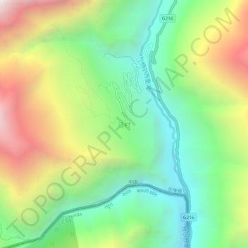
Name: Chang topographic map, elevation, terrain.

Location: Chang, Kyirong County, Shigatse Prefecture, Tibet, China (28.29342 85.31659 28.33342 85.35659)

Average elevation: 2,625 m

Minimum elevation: 1,879 m

Maximum elevation: 3,804 m

Gear up for your next adventure:

🥾Durable Hiking Shoes - Long-lasting shoes for frequent hiking
🧥Thermal Layer - Insulating layer for cold outdoor conditions
🧥Ultralight Puffy Jacket - Maximum warmth that packs down to the size of an orange
👟Sport Hiking Sandals - Breathable footwear for water crossings and camp rest
🥾Waterproof Hiking Boots - Boots keeping your feet dry in wet conditions

As an Amazon Associate, this site earns from qualifying purchases at no extra cost to you.