Geolocate

Sapuyes topographic map

Click on the map to display elevation.

About this map

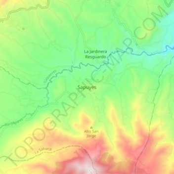
Name: Sapuyes topographic map, elevation, terrain.

Location: Sapuyes, La Sabana, Nariño, RAP Pacífico, Colombia (0.99772 -77.66092 1.07772 -77.58092)

Average elevation: 3,050 m

Minimum elevation: 2,691 m

Maximum elevation: 3,612 m

Gear up for your next adventure:

🌬️Windproof Camp Stove - Efficient cooking even on exposed mountain peaks
🛰️Satellite Messenger - Emergency communication for areas with no cell service
Lightweight Backpacking Tent - Compact tent for efficient hiking trips
🧴Outdoor Sunscreen - High SPF protection for high-altitude UV exposure
🥾Trail Running Boots - Durable shoes designed for trail running

As an Amazon Associate, this site earns from qualifying purchases at no extra cost to you.