
Thank you for supporting this site ❤️
Make a donation
Make a donation
Gear up for your next adventure:
As an Amazon Associate, this site earns from qualifying purchases at no extra cost to you.
Ossola topographic map
Click on the map to display elevation.
Thank you for supporting this site ❤️
Make a donation
Make a donation
Gear up for your next adventure:
As an Amazon Associate, this site earns from qualifying purchases at no extra cost to you.
About this map
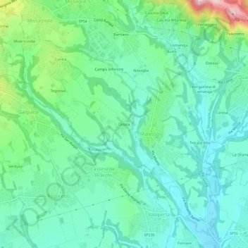
Name: Ossola topographic map, elevation, terrain.
Location: Ossola, Maresso, Missaglia, Lecco, Lombardije, 23873, Italië (45.66883 9.32694 45.70883 9.36694)
Average elevation: 288 m
Minimum elevation: 228 m
Maximum elevation: 473 m
Thank you for supporting this site ❤️
Make a donation
Make a donation
Gear up for your next adventure:
As an Amazon Associate, this site earns from qualifying purchases at no extra cost to you.