Geolocate

Rajganj topographic map

Click on the map to display elevation.

About this map

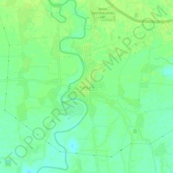
Name: Rajganj topographic map, elevation, terrain.

Location: Rajganj, Jalpaiguri District, West Bengal, 735134, India (26.53560 88.49567 26.57560 88.53567)

Average elevation: 93 m

Minimum elevation: 85 m

Maximum elevation: 98 m

Gear up for your next adventure:

🧥Softshell Jacket - Windproof and breathable jacket for hiking
🪑Ultralight Camping Stool - Compact seating for rest stops during long hikes
👟Leg Gaiters - Keep debris, mud, and snow out of your boots
🥾Hiking Leggings - Comfortable leggings for outdoor activities
🪑Insulated Seat Pad - Protect your seat from cold rocks and wet logs

As an Amazon Associate, this site earns from qualifying purchases at no extra cost to you.