
Voorstonden topographic map
Interactive map
Click on the map to display elevation.
About this map
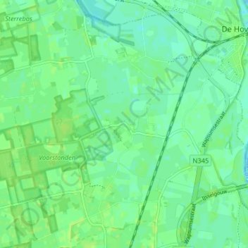
Name: Voorstonden topographic map, elevation, terrain.
Location: Voorstonden, Brummen, Gelderland, Nederland, 6971 KP, Nederland (52.10797 6.13297 52.14797 6.17297)
Average elevation: 8 m
Minimum elevation: 3 m
Maximum elevation: 12 m
Other topographic maps
Click on a map to view its topography, its elevation and its terrain.
Oeken
Nederland > Gelderland > Brummen
Oeken, Brummen, Gelderland, Nederland, 6971 KL, Nederland
Average elevation: 9 m