Geolocate

Luhrig topographic map

Click on the map to display elevation.

About this map

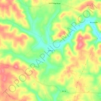
Name: Luhrig topographic map, elevation, terrain.

Location: Luhrig, Athens, Athens County, Ohio, United States (39.31341 -82.20320 39.35341 -82.16320)

Average elevation: 242 m

Minimum elevation: 197 m

Maximum elevation: 282 m

Other topographic maps

Click on a map to view its topography, its elevation and its terrain.

Pratts Fork

United States > Ohio > Athens County > Athens

Average elevation: 254 m

Gear up for your next adventure:

🌡️Emergency Mylar Blankets - Compact thermal protection for unexpected nights outdoors
🧴Bear Spray Holster - Quick-access carry for essential Canadian wilderness safety
🧦Hiking Liner Socks - Thin base layer to prevent friction and blisters
🦟Insect Repellent - Keep mosquitoes and black flies away in wooded areas
🎒Backpack Rain Cover - External shield to keep your entire pack dry

As an Amazon Associate, this site earns from qualifying purchases at no extra cost to you.