
Atatürk Mahallesi topographic map
Interactive map
Click on the map to display elevation.
About this map
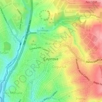
Name: Atatürk Mahallesi topographic map, elevation, terrain.
Location: Atatürk Mahallesi, Çayırova, Kocaeli, Marmara Region, Turkey (40.82821 29.36634 40.84305 29.39329)
Average elevation: 84 m
Minimum elevation: 17 m
Maximum elevation: 160 m
Other topographic maps
Click on a map to view its topography, its elevation and its terrain.
Çayırova Mahallesi
Çayırova Mahallesi, Çayırova, Kocaeli, Marmara Region, 41420, Turkey
Average elevation: 50 m